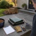
An irrigation problem is much easier to discuss when everyone can locate it. “The back is dry” may refer to one corner, an entire zone, or a patch affected by shade and roots. A simple observation map organizes what you see without asking you to open valves, adjust electrical controls, or diagnose the system yourself.
The goal is to create a safe, accurate record for an irrigation professional or landscape provider to evaluate on site.
Sketch the Main Property Features
Draw the outline of the house and label the front, rear, and side yards. Add major planting beds, lawn areas, paved surfaces, fences, slopes, and any irrigation equipment that is plainly visible from normal access. Mark the controller’s general location, but do not open unfamiliar electrical enclosures.
If zone numbers are already known from a controller label or prior service record, add them. Otherwise, use neutral area names such as “front lawn” or “rear border.” Avoid guessing which underground line serves an area.
Record What Happens During Normal Operation
Observe the system only during its usual scheduled cycle or with a qualified provider present. Note the date, start time, weather, and which area is operating. Mark heads that do not rise, emit an unusual pattern, or appear blocked by plant growth. For drip areas, record visible dry or overly wet sections rather than pulling tubing apart.
Use different symbols for common observations. A circle might show an area that remains dry, a triangle could mark overspray onto pavement, and a star might identify pooling or a visible leak. Add a short written key so another person can read the map.
Stay on stable, normally accessible surfaces. Do not enter flooded areas, reach into valve boxes, or work around damaged wiring. If water is flowing where it could affect a building, roadway, electrical equipment, or unstable ground, stop normal use if that can be done safely and contact an appropriate professional.
Compare Coverage With Site Conditions
Irrigation output is only part of the picture. Mark slopes where water runs away before soaking in, dense plant growth that may interrupt spray, compacted traffic areas, and places shaded for much of the day. Note recent changes such as new planting, removed shrubs, hardscape installation, or a moved fence.
Also record what is not affected. If most of a lawn looks consistent except for one edge, show that boundary. If pooling occurs only after rainfall as well as irrigation, write that down. These comparisons help separate a repeated operating pattern from a one-time observation.
Add Useful Photos and Records
Take an establishing photo that shows the location in context, followed by a closer image if it can be captured safely. Name each photo with the map area and date. A short video of normal operation can help document a changing spray pattern, but it should not require standing in a slippery or unsafe place.
Attach any available zone list, controller schedule, prior repair note, or planting plan. Do not change settings merely to make the record look more complete. Current, untouched conditions are often more informative.
Turn the Map Into a Service Conversation
When reviewing the map, identify your main concern: plant stress, wasted water, overspray, pooling, inconsistent coverage, or a schedule that no longer matches the landscape. Ask the provider to confirm affected zones, visible equipment conditions, and any recommended adjustments or repairs.
After service, update the same map with the date and completed scope. Note any areas that still need observation. Over time, this becomes a practical property record that connects irrigation behavior with changes in planting, weather, and use—without replacing professional inspection or encouraging unsafe DIY work.